Along the Katanga. Places of Power of Siberia
People are now meeting more and more often, along the banks sometimes field camps of mowers flaunt. Now is the hay time. Already on the approaches to Vanavara, we even had to work out with a private cab. A man stands on the left bank and shouts loudly, trying to attract the attention of those who are on the other bank and, probably, are sleeping in a tent. He saw us, asked for help, you, they say, disturb these loafers there, let them transport me to their place. Yes, what is there, we ourselves can transport. So they earned for lunch, fed us delicious borscht.
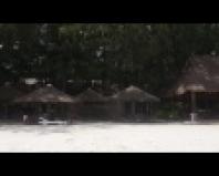
On this day, they did not go to the village, it was already late. All necessary establishments are closed. We got up for the night almost three kilometers away. But the village is visible from here, standing on a hill on the right bank. We went there in the morning, the catamaran was left at the boat parking. The owners of the boats are guarding in turn, sitting in a beam, set up for this right here, on the shore. Today's duty officer was asked to look after our household. There is nothing special for us to do in the village, only to call our relatives and buy grubs. Almost at the entrance to the village, the cafe "Meteorite" laughed with its name, it's a pity it's closed. Yes, this, still not understood phenomenon, eclipsed the river itself with its glory. It was precisely not far from Vanavara that this terrible explosion occurred over the taiga in 1908. If it were somewhere in America, the Vanavarans would live in clover and the cafe would not close, but only open. They would spin the car of the tourism industry. It may be for the best that not America is here, but Russia, and therefore not only corners, but simply vast territories, have not yet been touched. But it is necessary, but the locals survive at the expense of the taiga. Actually, as for many hundreds of years and earlier. And apparently, life is not so bad. The village is clean, there are enough shops, everything you need is available. Communication with the world is also established, they got through without problems. The main difficulty here is the delivery of the necessary fuel. And without it, in any way, electricity is provided by a diesel power plant. Delivery is not easy, in the spring down the river, but it is far away and the rapids interfere. In winter, when the swamps freeze, winter roads open. Vanavara is also many years old, from time immemorial the Evenks have set up their camps in this place. And then one Russian family, Vanya and Varya, settled down. This is where the name Vanavara came from. But this is just a version. Now there is a mixed population, and perhaps there will be more Russians. And only something about three thousand live. An-24 flies to Krasnoyarsk three times a week. And I've been here before. In 1999, our plane made an intermediate landing at the Vanavara airport on the way to Tura.
All city affairs did not take much time, it's time to return to the shore and move on. The duty officer at the boat parking, although he did not forget about hospitality, treated him to tea, but he also showed vigilance. He asked me to wait a bit, and he went to the village on a motorcycle, supposedly he needed something there. He returned quickly, and five minutes later, as if by chance, the hunting inspector showed up. Do we have unregistered weapons? Yes, we don’t have any, instead of guns, only tripods, which they demonstrated.
Directly opposite Vanavara, on the opposite bank, one can see a kilometer mark. And she announces that there are 1145 kilometers left to the mouth. The path is not close already passed, the distance is about a third. Now we are waiting for the second third, this is just from Vanavara to Baykit. The two largest settlements on the river are conveniently located, they divide it into approximately three equal parts.
I must say that the second third was the most monotonous and uninteresting. That's why it took the least time. It took only two weeks for this 600 km section. And the river is not moving badly, it helps. There is a current almost everywhere, and the rapids are sometimes not very difficult. The landscapes are nothing special, it remains only to catch some rare conditions. So this part was not even remembered somehow, as if everything was done in one day. Yes, and consciousness has already been rebuilt and the perception of time has changed. What seemed unusual and unusual became natural and ordinary. It is understandable why the locals are surprised that people from afar come to them. But still, some impressions are remembered. The first residential village after Vanavara is called Oskoba. We did not go into it, but stopped for filming and for tea on the higher opposite bank. And they were amazed that for an hour while they were there, they did not notice a single local resident on the streets. Complete silence. They say that the Old Believers live there.
Between Oskoba and Miryuga there is a large section of the river called the Krivlyaki tract. And indeed, the river grimaces here, winding cool between the peas. Surprisingly, it was here that not a single winter hut was noticed along the banks, it would seem, in the most remote, hunting place. And not a single motor boat was met, now it is no longer a rarity in other places. In general, it is increasingly possible to spend the night in huts. Very rarely come across winter huts closed with a padlock, but basically, please, come in and live. Sometimes not even bad houses, at least move to a permanent place of residence. This is familiar to me from the experience of other travels, but Kirill never ceases to be surprised at such communism. But in fact, hanging locks does not make much sense. A good person will not take anything and leave everything in perfect order, but a castle is not an obstacle for a bad person.
Immediately after the next village of Miryuga, we spent the night at the mouth of the right tributary called Podporozhnaya, passed a little above the threshold, which is why it is called so. Morning pleased dancing mist over the surface of the water. Probably, at the confluence of the two rivers, air currents of different temperatures formed, which caused a local condensation center in the form of a cloud of fog, constantly changing its configuration.
Just below the confluence of the Northern Tokura, we met the so-called ecological camp. With the money allocated by the administration of the Evenk District, children were taken here from Tura, allegedly to familiarize themselves with the traditions of their ancestors. An impromptu tent was set up, something is being made from birch bark. At the time of our arrival, most of the children had already been taken back to Baykit, and from there to Tura. There are only a few adults left, a girl of about five years old and still a toddler, plump-cheeked and funny, but looking at the guests seriously. With him, his grandmother says that she was once born in these places and this is the territory of her family. At one time there was a trail to the Angara.
At the mouth of the Kamo we visited a working weather station. Of course, we were treated to everything that was on the table. And there was a full frying pan of fried meat. And while we were eating, we heard enough from the already elderly head of the weather station the usual speeches about how bad it is to live now and how good it used to be. But as soon as he found out that we were from Moscow, Muscovites were to blame for everything. I have not been surprised at this for a long time, in distant lands it is customary to find fault and blame not only the government living in Moscow, but also the inhabitants of this city for their troubles.
Baykit was approached on the seventh of August. Rather, just like on Vanavara, we stopped to spend the night just above the village. Or rather, right at the mouth of a large right tributary, called Chunya. This evening presented an unforgettable sunset, a worthy decoration of our Tunguska photographic collection. We got to the village the next day, and even on the outskirts of it we had an unexpected acquaintance. We moored to the shore in order to remove Baykit from the side, and then a truck stopped nearby. There is a small section of the road along the coast to Chuna for hayfields. A tall man got out of the car, found out who we were, why and where, and then asked if we knew Vladimir Koval. At that time I was not personally acquainted, but what kind of landscape photographer does not know the Kovaly brothers. It was on Chun that the elder Koval, that is, Vladimir, has already spent many photographic seasons. And he stops in Baykit, as it turned out, just at this person. Well, what about Baykit. The village is not at all small, about five thousand inhabitants, almost a real city. And call where you need to be able to buy the necessary products. At that time, the catamaran again remained on the shore, under the supervision of watchmen at the boat parking lot.
In the middle reaches, the third largest tributary, the Podkamennaya Tunguska, flows into the Yenisei. The rapids river is distinguished by its peculiar wild beauty.

On the right bank of the Podkamennaya Tunguska stretch high wooded cliffs of the Yenisei Ridge. The most beautiful and majestic of them - the Sulomai Pillars, approached the river itself. They got their name from the nearby village of Sulomai, where representatives of one of the smallest peoples on Earth-Keto live compactly.
The natural park "Sulomaisky Pillars" is located in the Evenki municipal district (north of the Krasnoyarsk Territory). It is a mountain canyon with huge slopes, the height of which reaches 120 - 150 meters. Vertical pillars of various shapes, with a diameter of 6 to 10 meters, the height of which ranges from 30 to 80 meters. It covers an area of one thousand hectares. The unique ecosystem and the shape of the pillars, which are composed of basalt rocks. Their outlines resemble the figures of people and have their own names "Grandmother", "Mother", "Granddaughter", etc. 
Traveling along the Podkamennaya Tunguska and the Yenisei, you can get acquainted not only with nature, but also with the ethnic world, life and traditions of the locals.
ACTIVE TOUR PROGRAM along Podkamennaya Tunguska and Yenisei:
The first day
We will start our journey in Krasnoyarsk, a large cultural and historical center of Siberia. We will take time for an excursion around Krasnoyarsk. Let's admire the main symbols of the city - the chapel of Paraskevna Pyatnitsa on Karaulnaya Hill with a beautiful view of the city. In addition to the architectural monuments of the 18th-19th centuries, we will climb the chairlift, from where an even more magnificent view of the city, the surroundings and, most importantly, the Stolby Reserve opens. Let's take a walk. Next, we will have an excursion to the Museum of Local Lore, rightfully considered one of the best museums of the history and ethnography of Siberia.
Did you know that you see Krasnoyars every day?! 

Second day
After an early breakfast, we will say goodbye to the hospitable Krasnoyarsk and proceed to the international airport "Emelyanovo", from which we will fly to the Evenk village of Baikit. In just one hour and forty minutes of flight, we will find ourselves on the shore of the taiga beauty Podkamennaya Tunguska. From here we have to make a 545-kilometer trip along the marvelous river to the very mouth on a motoraft. (route II category of complexity)
Preparation. Departure, and now we are slowly cutting through the expanses of water Podkamennaya, admiring the panorama of untouched wildlife, stone placers, bizarre rock ledges. Overnight in a tent.
Day three
We continue our way along the winding and rocky river. Rocky massifs stretch along the left, then along the right bank. Solid mountains alternate with "feathers". Stop. Climb one of them. The panorama of the Tunguska floodplain opens up truly reserved. Overnight in a tent. 
Day four
We overcome a two-stage threshold without any special shafts, but with a powerful stream almost along the entire river. The mountains around become overgrown with forest. After one of the turns, following along a fairly powerful rift, we arrive at the first village on our route, Poligus, located on the mountainside. Acquaintance with the indigenous people of the village. Overnight. 

Day five
We overcome the one and a half kilometer "Flour threshold". The river here makes a wide turn, bounded on the right side by a high rocky "circus". Across the entire width in large numbers - low, but sharp multidirectional shafts, with a very powerful pressure. After the Flour Rapids, the mountains part again. Overnight in a tent.
Day six
We follow the "wide" sleeve along the large island. In the distance you can see high misty mountains - a real Siberian landscape. Tunguska continues to wind between the mountains, whirlpools appear. Overnight in a tent. 
Day seven
We overcome the seven-kilometer Big threshold. It consists of two steps. Shafts up to one and a half meters high, sharp and disorderly. The river gradually calms down, becomes wide. We get to a forest hay meadow, which stretches along the right bank. We settle down in the winter quarters. We do a day. We heat the bath! We are resting.
Day eight 
We arrive at the mouth of the left tributary of the Velmo River. We climb eight kilometers along it and visit the village of Burny. The place of residence of the Siberian Old Believers ("Kerzhaks") We get acquainted with the history, life and way of life of the Old Believers. Overnight.
Day nine
After the confluence of the Velmo River, Tunguska becomes like a mountain lake. Calm kilometer-wide mirror surface. Overnight in a tent. 
Day ten
We arrive in the Old Believer village of Kuzmovka. Acquaintance with the inhabitants, the history of the settlement of Siberian lands by ethnic Russians. We will find out why fellow believers support the "old way" based on respect for elders, hard work and respect for nature. Why do they not accept modern church and secular laws? How faith helps to survive in harsh climatic conditions. After eight kilometers, the Old Believer settlement of the "other branch" Kochumdek. Acquaintance with the inhabitants, history and way of life. Full immersion in the atmosphere of the XVII century. Only some details of our century bring back to reality. Overnight.
Day Eleven
We arrive at the borders of the Yenisei Stolbovoy State Reserve. Access to the right bank is prohibited. We follow to the mouth of the Stolbovaya River. Walking tour along the river bank to the waterfall. Overnight.
Day twelve
We are approaching the climax of our journey - the Sulomai Pillars. Tunguska shrinks, and along the banks there are many stone pillars in terraces leading to them from the water itself. Six mountain ranges successively approaching the Tunguska from different banks. Climbing poles. Only from here you can truly feel the greatness of the mountains surrounding you, between which the Siberian river flows quickly and powerfully. Daytime. Overnight. 
Day thirteen
We pass a wide pebbly beach, still framed by high, beautiful stone "feathers". A few more sharp turns between the rocks and Tunguska again spills into a one and a half kilometer wide and continues its way to the Yenisei among the low mountains. Arriving in the village of Sulomai. Acquaintance with representatives of the indigenous Keto people, history and crafts. We will taste dishes of the Evenki national cuisine. Whitefish, Chir, Muksun in slightly salted, dried and dried form. Chuken cooked on a fire. Tea from medicinal infusions of herbs. Overnight stay 

Day fourteen
Completion of the active part of the trip. It will not be sad, but this evening is farewell. Farewell to the Understone beauty. For two weeks of solitary stay in nature, we have already connected with the rhythms of sunrises and sunsets. Already captivated by the beauty. Still so fresh are the memories from the stories of the inhabitants met on the river and its banks. The adrenaline that stood out on the thresholds has not yet completely evaporated, and the gray-haired Yenisei is already hospitably opening its arms. Overnight. 
Day fifteen
The journey continues. Entry into the Yenisei. Crossing a three-kilometer riverbed to the village of Bor. Late in the evening, loading onto the ship next to the polar port city of Dudinka. 

Then we travel along the lower Yenisei, in the first-class cabin of the three-deck motor ship "Alexander Matrosov". How nice after "living in nature" to feel the first benefits of civilization. Take a warm shower, visit a restaurant or bar on the second or third deck, enjoy the landscapes of the Yenisei taiga passing by, slowly turning into the forest tundra. 

Day sixteen
The ship smoothly plows the expanses of the Yenisei. A few villages are left behind. Stop near the village of Bakhta, which gained worldwide popularity after the release of the documentary "Happy People". Spiritually strong fishermen and masters of ancient Siberian crafts live in Bakhta. If you're lucky, you might be able to meet some of them. 
In the evening, arrival in the village of Turukhansk, which is on the confluence of the Lower Tunguska. Visit to the Holy Trinity Monastery with its almost four hundred years of history. On this day, an acquaintance with another religion rooted in Siberia - Orthodoxy will take place. Now the ideological idea of the Siberian man is the most complete. This is how pagans (Samoyeds), Old Believers (Kerzhaks) and Orthodox (baptized) get along in the distant taiga wilderness. 
Day seventeen
Late at night (in the midst of the polar day) we cross the Arctic Circle. The sun, high above the horizon, reflects on the waves with its reflections. The river and the village of the same name Kureika. Where the “father of all peoples” I.V. Stalin
In the afternoon we arrive in the port city of Igarka. Visiting the unique, the only museum in the world "Permafrost". We go down to a depth of 12 meters and examine in a block of ice, relict trees frozen into the soil, whose age is a little more than 65 million years. 
Late in the evening we arrive in Dudinka. Sea gates of the Taimyr Peninsula. Huge icebreakers and nimble tugboats, as well as bright, colorful houses on the permafrost and the original national culture of the indigenous peoples of the Far North. Farewell to the Yenisei. Overnight at the hotel. 
Day eighteen
Visit to the Museum of Local Lore, Center of Folk Art. Moving to the city of Norilsk, the pearl of the Arctic. The northernmost city in the world. The northernmost factories and mines in the world. Whoever has not seen this city wants to visit it, whoever has visited will never remain indifferent.
Transfer to Alykel airport. Direct flights to the cities of Moscow and St. Petersburg.
And so our journey through Siberia ends. Behind already covered thousands of kilometers along the Podkamennaya Tunguska and the majestic Yenisei. 
Impressions from the landscapes you have seen, stories you have heard will warm you with the warmth of Siberian hospitality for many years to come. All the best, dear travelers. Welcome to Siberia!!!
We arrive at the beginning of the program on June 8 in Krasnoyarsk, fly home on June 29 from Norilsk,
We're grabbing tickets!
The budget for an active tour in Siberia: 53,700 rubles.
Included in the price:
Accommodation in a hotel in Krasnoyarsk - 2500 rubles
Flight Krasnoyarsk - Baykit (7800 rubles)
Rafting on a motoraft along Podkamennaya Tunguska, three meals a day, accommodation in prepared camping conditions - 29,300 rubles
Travel by boat in a cabin of the 1st class in the village of Bor - the city of Dudinka (9900 rubles)
(Meals on board the ship at your own discretion are paid separately)
Accommodation in a hotel in Dudinka - 2500 rubles
Transfer to Norilsk - 1700 rubles
Additional costs during our active walking tour:
Meals on the ship and in the mountains
Flight from home to Krasnoyarsk
Flight from Norilsk to home
Personal expenses
Tours with Sergey Kuznetsov:
-
-
Ending. Beginning in the previous three posts.
So, another third of the total distance has been covered, only one out of three has remained. And as it turned out, and as expected, this is the most photogenic part of the river. Now we know our capabilities, we know that the remaining distance is not so great and will not take too long. Therefore, you can change tactics a bit and allow yourself to linger longer in some of the most interesting places. And this part of the river is famous precisely for its pillars, that is, the remnants. And if you have the task of simply taking pictures of beautiful landscapes without fail on Podkamennaya Tunguska, while not straining yourself with a long route, then for this you need to fly on a local plane from Krasnoyarsk to Baykit and start your rafting from here.
The first complexes of remains worthy of serious attention, or the so-called pillars, begin already 20 kilometers below the village and stretch for five kilometers. Unlike those that were found at the very top, in Katanga, these remnants are composed of basalts and therefore have a slightly different appearance. Those were nevertheless monolithic and with smooth forms. The same ones seem to be made of bricks, even slightly reminiscent of the structures in the children's game "Lego". They stand guard along the banks, as if guarding the river. Or suddenly there will be fortress walls, otherwise something else wonderful is guessed. Particularly rich in remnants are small canyon-like gorges formed by short side streams, and they arranged day trips in them in search of favorable angles. But the weather did not really allow to reveal all the possibilities. At one such parking lot, where we spent a couple of days, I was lucky enough to get to know the local inhabitants relatively closely. As soon as we landed on the shore, it immediately became clear that a bear family lives here. Everything is trampled around, heaps are piled up, eloquently telling about the diet of the owners of this gorge. Apparently, a mother with two cubs is registered here. On the second day, the weather decided to give unlimited opportunities for work, and we dispersed from the camp, each in search of his own, the best angle. Rather, Kirill stayed somewhere closer to the entrance to the gorge, but it seemed to me that there was something better somewhere further away, and therefore, gradually, with work, he began to move up the gorge. And the higher he went, the more signs of the presence of local inhabitants he found. So I almost reached the very end of the gorge, it will not be more than two kilometers. This is where they made themselves known. It looks like they saw the intruder a long time ago, but they didn't reveal it. And here, we can say, pinned to the wall. The bear family, of course, could climb the hill and calmly leave. But this alignment, probably, seemed unfair to them. At some point, about a hundred meters from me, a roar of crumbling stones was heard across the stream, then a bear growled menacingly, and the cubs began to bark displeasedly. It was not possible to see the dissatisfied, the dense forest thickets that hid them did not let them. I did not dare to go further, after standing a little for order, I retreated. So the sovereignty of the inhabitants was respected, but we were also quietly allowed to work in the lower part of the gorge.
Podkamennaya Tunguska below Baikit.
As a matter of fact, the mouth of almost any tributary, both small and large, turned out to be interesting here. A long working stop turned out at the mouth of the Bolshaya Nirungda, a beautiful right tributary. They arrived wet and cold. The weather does not allow to relax, here again today I was amused by a cold rain with a headwind to boot. And the harbinger of this disgrace was an unusual silky cloudiness, which they were not even too lazy to capture. The discovered object, that is, the mouth of the Big Nirungda, left no doubt about the need to pay attention to it. Along the Tunguska itself, with a long and high wall near the shore, right up to the mouth of the tributary, remnants are built, and there are some along Nirungda. And the head of this whole series of statues is one bizarre stone structure, resembling either the head of a rooster, or a man in a hat. It is amazing how this figure, built of separate blocks and seemingly completely unstable, is still holding on. It is doubtful that in this form it will stand for a long time. But there was no suitable place for parking right away. As it turned out later, there is a hut just below the mouth, but they didn’t know about it then, and they wanted to stay higher, because this is where all the beauty is. In search of an acceptable place, we slightly delved into the forest and stumbled upon a path that led to a well-hidden, but solid hut. If anything brightens up the harsh life of such trips, then it is precisely such surprises, presented at the right time. The catamaran, along with all the belongings, was dragged up Nirungda, closer to the hut. Now you can fire up the stove, dry yourself calmly, cook dinner, have dinner at the table and lie down to sleep on spacious plank beds. In every journey there is some moment, some point of the route, the memories of which then warm the soul for a long time. On Podkamennaya Tunguska, this place turned out to be here, in a wonderful hut at the mouth of the beautiful Bolshaya Nirungda. And this despite the fact that they came here on the thirteenth on Friday.
The right bank of the Podkamennaya Tunguska at the mouth of the Big Nirungda. Here, in addition to landscape charms, one can observe an interesting geological section. The remains themselves are composed of basalts. And at the base, a strip of white rocks is noticeable. These are limestones. As you know, it is a product of marine sediments. Further, the area rose and became dry land, where volcanic eruptions later occurred. As a result, basalt covers were formed.
Bolshaya Nirungda before flowing into Podkamennaya Tunguska.
Stone idol at the mouth of the Big Nirungda.
The silky sky is a harbinger of bad weather.
Then we went down the river for several days without days, but we were not in a hurry, we paid attention to interesting objects. Right behind Nirungda there are two simple rapids with funny names - Grandmother and Grandfather. Here on the banks, pieces of jet are scattered here and there. Then there is a village with an unusual name - Poligus. They tried to get in touch with Moscow, but it turned out that there was no such possibility, either temporarily, or always. Immediately behind the rather nimble threshold of Muchnaya, they observed a large river transport thrown ashore, a barge towing vehicle. People fussed around him, they say, they sat down here in the spring, and still cannot be dragged into the water, but this must be done before freezing. That is why it is called this rapid, because at one time many barges with flour lost their cargo here and let the fish feed. Below the very large island of Kochenyatsky, we spent the night in a small company at the mouth of the left tributary of the Dyagdagli. This couple from Sverdlovsk, rafting from Baikit in a rubber boat, was met a long time ago. Periodically caught up, then again lagged behind, busy with work. And the island of Kochenyatsky, from the word to stiffen, seems to be so named because someone here is very cold, not having, for some reason, the opportunity to move ashore.
The village of Poligus. Skyscraper - administration building. Friendly woman - deputy head of administration.
Disaster in front of the flour threshold.
Island Kochenyatsky.
Morning is somewhere behind Kochenyatsky.
There.
River.
Then came the time of the Great Threshold. The severity of this impediment was difficult to gauge from the scant descriptions in old travel reports. But the locals were a little scared. Indeed, the threshold turned out to be the most significant on the entire river, I had to strain a little. But in fact, for rafting on a catamaran, this obstacle is not dangerous. But it turned out that the threshold is two-stage, which they did not know about. The second, no less powerful step, accepted us when we were already relaxed and victoriously looking ahead, but we immediately had to duplicate everything. However, the obstacle was left behind, causing no damage other than a little water splashing over my right leg. The imminent end of the route became more conscious from that moment on. Only a series of Velma rapids loomed ahead, and then even water all the way to the Yenisei.
Once we spent the night, not reaching three kilometers from the mouth of a large left tributary called Velmo. We spotted a comfortable hut on the right bank. The Nizhny Baikitik, a small river, flows in nearby. They occupied the dwelling in a businesslike way, and a little later the real owners appeared, a man with a big beard and a boy, his son. They sailed on a motor boat, probably they were going to spend the night here, but they did not kick the guests out. Not only did they leave us what products they had, they also shared the grayling caught right there. Here, at the mouth of the Lower Baykitik, their grid stands. In general, these are residents of Burnoe. Above Velmo, seven kilometers from the mouth, there is a village with that name. In the same place, the river of the same name flows into Velmo. And real Old Believers live there, not bad, they say, they live. Now it’s not even bad to be Old Believers, young people are not taken into the army.
Velmo brought a fresh stream into the waters of Podkamennaya Tunguska. For several kilometers, they seem to flow side by side, without mixing - transparent and greenish Velma water and brown water of Podkamennaya Tunguska. A series of Velminsky rapids did not surprise us, they passed calmly.
Old Believers from Burnoy.
Checking networks.
Haystacks at the mouth of Velmo
Behind the rapids I liked the mouth of the right tributary, under the unpronounceable name - Maigungna. The nimble and rapids river flows beautifully and noisily into Podkamennaya Tunguska. Just caught the flood, heavy rains tried. It can be said that Maigungna swelled up with yellow water before our eyes and tried to quickly dump the excess load into the big river with a frantic stream. This flood did not really affect Tunguska itself, the water level almost did not rise. Not far from the mouth, of course, they found a hut for our comfortable stay. Very small, you have to literally crawl into the doorway. It should be noted that in this part of the river, where the Old Believers live, for some reason all the huts are so small. Really, really asceticism is inherent in them. In the hut we somehow accommodated the two of us, but here we also had to make room, the guests arrived on a boat, carrying some cargo down the river. They left two men for fishing, and they themselves went further, they would pick it up on the way back. Well, in tight quarters, but not offended. We shared with each other what we could. We spent three days on Maigungna, still the weather did not allow to reveal the creative potential of this place. And the wind was such that a standing tripod easily fell to the ground. But we still had a few interesting moments, and waited for meager glimpses of the sun.
Maygunna is the right tributary of the Podkamennaya Tunguska.
Flood at Maigungna.
Maygunna.
At the mouth of the Maygunna.
And then, in working order, they began to slowly move towards the exit from the river. A little higher than the village of Sulomai, above the island of Cherny, the mountains finally, as if saying goodbye, squeeze the Podkamennaya Tunguska in their arms, so that later they will let go completely to the Yenisei itself. This place is called Cheeks here. The shores of farewell delight the eye with their stone statues, the river meanders beautifully in a narrow and deep passage. In Shcheki we also spent the night in a small hut. It stands on a steep bank, high from the water, twenty or thirty meters vertically, but, apparently, in the spring the water rises right under this hut. So cramped is this stone neck, which serves as a kind of gate on the way to the Yenisei.
Podkamennaya Tunguska in "Cheeks".
In "Cheeks" stone sculptures also indulged in their subjects. This one is clearly an Indian in profile.
Group self-portrait. Cyril in the foreground. Somewhere before the exit to the Yenisei. Someone, looking at this picture, said: - well, you are like brothers here. Well, yes, two months together, in taiga conditions. Overgrown slightly.
They reached the Yenisei on August 28, safely crossed this huge river from the right to the left bank and stopped at the pier in the village of Bor. Here we had to wait a couple of days for a passing steamer to Krasnoyarsk, and here our long journey along Podkamennaya Tunguska ended, a river worthy of dreaming about, worthy of a dream come true.
Well, for a snack - berries, mushrooms.
Stone berry.
Currant - sour.
Karpukhin Sergey.
Podkamennaya Tunguska, often called Middle, among the northern peoples of Katanga, a beautiful river reservoir, it flows through the Krasnoyarsk Territory, flows into the Yenisei on the right. With a duration of 1865 km, it collects its waters from a vast territory of 240 thousand km². Its sources are located in the spurs of the Angara Ridge, the main current passes through a heterogeneous relief. The river in the upper reaches is located in a deep, widened, rapids, gorge-like valley with strong volcanic rocks. Such areas are called traps. When weathered, they form the famous outcrops « pillars » .
Above the mouth of the river Tetere, Katanga is stormy and rapids in narrow sections. At 535 km of the river there is the Bolshoy rapid, which is very popular with tourists from water specialists, at 417 km the rapid is interesting. « Flour, rapids « Polyguzskie » and "Velminsky » , many rolls are swift and spectacular. In the lower reaches of the river valley expands to 20 km.
The high rocky banks of the river with basalt remnants "pillars" are overgrown with dense forest. "Pillars", scientifically traps, appeared in the relief 250 million years ago as a result of a powerful eruption of an ancient volcano. But the volcano did not completely melt the permafrost, and where it succeeded, canyons appeared cutting the landscape. Later, lava flows spread, leveling the relief over a vast territory. The stony rocky channel of the Siberian river is a group of canyons, a tectonic fault on the Central Siberian Plateau. The fault was filled from underground water layers.
Where did the name of the river come from
One of the indigenous, quite numerous peoples of Siberia, the Evenks are the Tungus, literally “the people overcoming the ridges”, after his name the river was called the Tunguska. Podkamennaya, because a large river has developed a valley for itself through the solid rocks of the Yenisei Ridge, it is called Stone in these places. To the confluence of the Tetere River, the Tunguska is called Katanga. The ancient Evenki word "kata" means "knife". In a general translation, "water stinks with cold, like a knife."

Hydrological regime
The river is mainly fed by snow up to 60%, 16% by rain and 24% by underground groundwater. The flood runs from May to June. Summer low water lasts from July to October, floods are observed in summer, they raise the level of river water to 5.5 meters. Water consumption for the year is 1587.18 m³/s, during floods up to 35 thousand m³/s. Ice on the river rises from October to May. Ice drift lasts from 5 to 10 days. In winter, 11% of the total annual runoff passes through the channel.
tributaries of the river
Large tributaries of the river on the left are the rivers Velmo and Kamo; on the right are the rivers Chunya, Chula and Tetere.
river use
For 1146 km the river is navigable; in high water up to 571 km up to Baykit, above the cargoes are transported by boats with barges, in the usual level up to 275 km to the confluence of the river Velmo.
Usually, during the shipping season, tandems of barges and large boats work on the river to transport goods. 30 species of commercial fish live in the river. Valuable prey for local fishermen, and these are all the inhabitants of the river basin, are fishing for grayling, perch, taimen, ide, lenok, pike.
There are no roads and no bridges on the large river. In about a dozen rural settlements, there are several hundred or up to one thousand inhabitants. About 80 people live in the village of the same name, about 2 thousand people live in the village of Bor, more than 5 thousand people live in the large village of Baykit, and more than 3 thousand people live in Vanavara. It has all the infrastructure, schools, kindergartens, feldsher and medical centers, they are provided with electricity by diesel power plants. The farm always has an SUV or a boat with a motor.
Residents do not complain about harsh conditions. Local youth study in Krasnoyarsk or Tura. The inhabitants of the Podkamennaya Tunguska basin are descendants of marriages between Russian settlers and Evenks. A large Old Believer Russian village is Kuzmovka with a population of 187 people.

History of the development of the river
Ancient Neolithic, Bronze and Iron Age settlements are known to archaeologists in the river basin. According to numerous studies, they were the direct ancestors of the modern Tungus. From the 12th century they lived from the shores of the Arctic to Mongolia. Since ancient times, the traditional occupations of the Tungus were reindeer herding and hunting.
In the summer of 1621, the Cossacks from the Surgut region, the Fedorov brothers, found “new lands” on Tunguska, they noted in their diary that “there are 60 Tungus people here, and there were no Russians here yet.” In the next two years, the first tribute from 21 sable skins was collected from the local Tungus. In 1625, the chieftain with the Cossacks Pozdey Firsov explored the lands on the Middle Tunguska. In the 1730s, 4 yasak hunting winter quarters were built here. From the place where it flows into the Yenisei, respectively, Podkamennoye, then Chunskoye or Chyumskoye, up Chapagirskoye and later Teterskoye was built. By the end of the 19th century, the merchant gold miner Vasily Latkin was doing business with the Evenks. Settlements of gold diggers were built everywhere, modern villages grew out of them.
Settlements on Podkamennaya Tunguska
On the banks of the river there are rural settlements Podkamennaya Tunguska (80 people), Baykit (5 thousand people), Vanavara (3 thousand people), Bor (2 thousand people).

What is interesting about the river Podkamennaya Tunguska
Stony Tunguska became widely known in the world after the fall of June 17 (30), 1908, it was called Tunguska. The event occurred upstream of the confluence of the Vanavark. Here it was created later on an area of 20,241 hectares. The central estate of the protected area is located in Vanavare. 145 species of rare birds, up to 40 species of various mammals, moose, lynx, brown bears, Siberian sable are protected by the state here.
In the village of Bor is the central estate of the Central Siberian Biosphere Reserve, with a total area of 972,017 hectares. 46 species of rare mammals live and are protected by the state on its territory, 600 species of vegetation grow, and 34 species of commercial fish grow in reservoirs.
In Vanavara there is a museum exposition of the famous Tunguska meteorite, founded by V.I.Voronov in 1990.
Zonal scientific observatory in the village of Bor, a unique specialized institution in the entire Krasnoyarsk Territory. It conducts meteorological observations and specialized measurements in hydrology, constant observations of radio waves, the planet's magnetic field and the ionosphere. The obtained data are constantly transmitted by scientists to the Geophysical Institute of the Russian Academy of Sciences in Moscow.
So, another third of the total distance has been covered, only one out of three has remained. And as it turned out, and as expected, this is the most photogenic part of the river. Now we know our capabilities, we know that the remaining distance is not so great and will not take too long. Therefore, you can change tactics a bit and allow yourself to linger longer in some of the most interesting places. And this part of the river is famous precisely for its pillars, that is, the remnants. And if you have the task of simply taking pictures of beautiful landscapes without fail on Podkamennaya Tunguska, while not straining yourself with a long route, then for this you need to fly on a local plane from Krasnoyarsk to Baykit and start your rafting from here.
The first complexes of remains worthy of serious attention, or the so-called pillars, begin already 20 kilometers below the village and stretch for five kilometers. Unlike those that were found at the very top, in Katanga, these remnants are composed of basalts and therefore have a slightly different appearance. Those were nevertheless monolithic and with smooth forms. The same ones seem to be made of bricks, even slightly reminiscent of the structures in the children's game "Lego". They stand guard along the banks, as if guarding the river. Or suddenly there will be fortress walls, otherwise something else wonderful is guessed. Particularly rich in remnants are small canyon-like gorges formed by short side streams, and they arranged day trips in them in search of favorable angles. But the weather did not really allow to reveal all the possibilities. At one such parking lot, where we spent a couple of days, I was lucky enough to get to know the local inhabitants relatively closely. As soon as we landed on the shore, it immediately became clear that a bear family lives here. Everything is trampled around, heaps are piled up, eloquently telling about the diet of the owners of this gorge. Apparently, a mother with two cubs is registered here. On the second day, the weather decided to give unlimited opportunities for work, and we dispersed from the camp, each in search of his own, the best angle. Rather, Kirill stayed somewhere closer to the entrance to the gorge, but it seemed to me that there was something better somewhere further away, and therefore, gradually, with work, he began to move up the gorge. And the higher he went, the more signs of the presence of local inhabitants he found. So I almost reached the very end of the gorge, it will not be more than two kilometers. This is where they made themselves known. It looks like they saw the intruder a long time ago, but they didn't reveal it. And here, we can say, pinned to the wall. The bear family, of course, could climb the hill and calmly leave. But this alignment, probably, seemed unfair to them. At some point, about a hundred meters from me, a roar of crumbling stones was heard across the stream, then a bear growled menacingly, and the cubs began to bark displeasedly. It was not possible to see the dissatisfied, the dense forest thickets that hid them did not let them. I did not dare to go further, after standing a little for order, I retreated. So the sovereignty of the inhabitants was respected, but we were also quietly allowed to work in the lower part of the gorge.
As a matter of fact, the mouth of almost any tributary, both small and large, turned out to be interesting here. A long working stop turned out at the mouth of the Bolshaya Nirungda, a beautiful right tributary. They arrived wet and cold. The weather does not allow to relax, here again today I was amused by a cold rain with a headwind to boot. And the harbinger of this disgrace was an unusual silky cloudiness, which they were not even too lazy to capture. The discovered object, that is, the mouth of the Big Nirungda, left no doubt about the need to pay attention to it. Along the Tunguska itself, with a long and high wall near the shore, right up to the mouth of the tributary, remnants are built, and there are some along Nirungda. And the head of this whole series of statues is one bizarre stone structure, resembling either the head of a rooster, or a man in a hat. It is amazing how this figure, built of separate blocks and seemingly completely unstable, is still holding on. It is doubtful that in this form it will stand for a long time. But there was no suitable place for parking right away. As it turned out later, there is a hut just below the mouth, but they didn’t know about it then, and they wanted to stay higher, because this is where all the beauty is. In search of an acceptable place, we slightly delved into the forest and stumbled upon a path that led to a well-hidden, but solid hut. If anything brightens up the harsh life of such trips, then it is precisely such surprises, presented at the right time. The catamaran, along with all the belongings, was dragged up Nirungda, closer to the hut. Now you can fire up the stove, dry yourself calmly, cook dinner, have dinner at the table and lie down to sleep on spacious plank beds. In every journey there is some moment, some point of the route, the memories of which then warm the soul for a long time. On Podkamennaya Tunguska, this place turned out to be here, in a wonderful hut at the mouth of the beautiful Bolshaya Nirungda. And this despite the fact that they came here on the thirteenth on Friday.
Then we went down the river for several days without days, but we were not in a hurry, we paid attention to interesting objects. Right behind Nirungda there are two simple rapids with funny names - Grandmother and Grandfather. Here on the banks, pieces of jet are scattered here and there. Then there is a village with an unusual name - Poligus. They tried to get in touch with Moscow, but it turned out that there was no such possibility, either temporarily, or always. Immediately behind the rather nimble threshold of Muchnaya, they observed a large river transport thrown ashore, a barge towing vehicle. People fussed around him, they say, they sat down here in the spring, and still cannot be dragged into the water, but this must be done before freezing. That is why it is called this rapid, because at one time many barges with flour lost their cargo here and let the fish feed. Below the very large island of Kochenyatsky, we spent the night in a small company at the mouth of the left tributary of the Dyagdagli. This couple from Sverdlovsk, rafting from Baikit in a rubber boat, was met a long time ago. Periodically caught up, then again lagged behind, busy with work. And the island of Kochenyatsky, from the word to stiffen, seems to be so named because someone here is very cold, not having, for some reason, the opportunity to move ashore.
Then came the time of the Great Threshold. The severity of this impediment was difficult to gauge from the scant descriptions in old travel reports. But the locals were a little scared. Indeed, the threshold turned out to be the most significant on the entire river, I had to strain a little. But in fact, for rafting on a catamaran, this obstacle is not dangerous. But it turned out that the threshold is two-stage, which they did not know about. The second, no less powerful step, accepted us when we were already relaxed and victoriously looking ahead, but we immediately had to duplicate everything. However, the obstacle was left behind, causing no damage other than a little water splashing over my right leg. The imminent end of the route became more conscious from that moment on. Only a series of Velma rapids loomed ahead, and then even water all the way to the Yenisei.
Once we spent the night, not reaching three kilometers from the mouth of a large left tributary called Velmo. We spotted a comfortable hut on the right bank. The Nizhny Baikitik, a small river, flows in nearby. They occupied the dwelling in a businesslike way, and a little later the real owners appeared, a man with a big beard and a boy, his son. They sailed on a motor boat, probably they were going to spend the night here, but they did not kick the guests out. Not only did they leave us what products they had, they also shared the grayling caught right there. Here, at the mouth of the Lower Baykitik, their grid stands. In general, these are residents of Burnoe. Above Velmo, seven kilometers from the mouth, there is a village with that name. In the same place, the river of the same name flows into Velmo. And real Old Believers live there, not bad, they say, they live. Now it’s not even bad to be Old Believers, young people are not taken into the army.
Velmo brought a fresh stream into the waters of Podkamennaya Tunguska. For several kilometers, they seem to flow side by side, without mixing - transparent and greenish Velma water and brown water of Podkamennaya Tunguska. A series of Velminsky rapids did not surprise us, they passed calmly.
Behind the rapids, I liked the mouth of the right tributary, under the unpronounceable name - Maigungna. The nimble and rapids river flows beautifully and noisily into Podkamennaya Tunguska. Just caught the flood, heavy rains tried. It can be said that Maigungna swelled up with yellow water before our eyes and tried to quickly dump the excess load into the big river with a frantic stream. This flood did not really affect Tunguska itself, the water level almost did not rise. Not far from the mouth, of course, they found a hut for our comfortable stay. Very small, you have to literally crawl into the doorway. It should be noted that in this part of the river, where the Old Believers live, for some reason all the huts are so small. Really, really asceticism is inherent in them. In the hut we somehow accommodated the two of us, but here we also had to make room, the guests arrived on a boat, carrying some cargo down the river. They left two men for fishing, and they themselves went further, they would pick it up on the way back. Well, in tight quarters, but not offended. We shared with each other what we could. We spent three days on Maigungna, still the weather did not allow to reveal the creative potential of this place. And the wind was such that a standing tripod easily fell to the ground. But we still had a few interesting moments, and waited for meager glimpses of the sun.
And then, in working order, they began to slowly move towards the exit from the river. A little higher than the village of Sulomai, above the island of Cherny, the mountains finally, as if saying goodbye, squeeze the Podkamennaya Tunguska in their arms, so that later they will let go completely to the Yenisei itself. This place is called Cheeks here. The shores of farewell delight the eye with their stone statues, the river meanders beautifully in a narrow and deep passage. In Shcheki we also spent the night in a small hut. It stands on a steep bank, high from the water, twenty or thirty meters vertically, but, apparently, in the spring the water rises right under this hut. So cramped is this stone neck, which serves as a kind of gate on the way to the Yenisei.
They reached the Yenisei on August 28, safely crossed this huge river from the right to the left bank and stopped at the pier in the village of Bor. Here we had to wait a couple of days for a passing steamer to Krasnoyarsk, and here our long journey along Podkamennaya Tunguska ended, a river worthy of dreaming about, worthy of a dream come true.
 (1 ratings, on average: 5,00 out of 5)