James Cook. Discoverer of Australia
History of discovery. Man appeared in Australia 40 thousand years ago. These were newcomers from South and Southeast Asia, the predecessors of modern aborigines. Having settled in the eastern part of Australia, people also entered Tasmania. The fact that Tasmanians are descendants of ancient Australians is confirmed by recent archaeological finds on Hunter Island in Bass Strait.
Assumptions about the existence of the mysterious Terra incognita Australis - “Unknown Southern Land” south of the equator were expressed by ancient geographers. A vast area of land in the southern hemisphere was depicted on maps in the 15th century, although its outline did not resemble Australia in any way. The Portuguese had some information regarding the northern coasts of Australia back in the 16th century; they came from the inhabitants of the Malay Islands, who visited the coastal waters of the mainland to catch sea cucumbers. However, until the 17th century, no Europeans managed to see Australia with their own eyes.
The discovery of Australia has long been associated with the name of the English navigator James Cook. In fact, the first Europeans to visit the coast of this continent and meet scattered Aboriginal tribes here were the Dutch: Willem Janszoon in 1605 and Abel Tasman in 1642. Janszon crossed the Torres Strait and sailed along the coast of the Cape York Peninsula, while Tasman discovered the southwestern part of Tasmania, which he considered part of the mainland. And the Spaniard Torres in 1606 sailed through the strait that separates the island of New Guinea from the mainland.
However, the Spaniards and Dutch kept their discoveries secret. James Cook sailed to the east coast of Australia only one hundred and fifty years later, in 1770, and immediately declared it an English possession. A royal “penal colony” was created here for criminals, and later for exiled participants in the Chartist movement in England. Representatives of the English authorities, who sailed to the shores of Australia with the “first fleet” in 1788, founded the city of Sydney, which was subsequently proclaimed the administrative center of the British colony of New South Wales, created in 1824. With the arrival of the “second fleet,” the first free migrants appeared. The development, or rather the seizure of the mainland, begins, accompanied by the most brutal extermination of the indigenous population. A hunt was organized for the aborigines, and bonuses were given for those killed. Often the colonists staged real raids on the indigenous people of Australia, killing them without distinction of gender or age, scattering poisoned food, after which people died in terrible agony. It is not surprising that after a hundred years most of the indigenous population was exterminated. The remaining aborigines were driven from the land of their ancestors and pushed into the interior desert regions. In 1827, England announced the establishment of its sovereignty over the entire continent.
The end of the 18th and the entire 19th century for Australia was a time of geographical discoveries. In 1797, the talented English hydrographer M. Flinders began exploring the coasts of the continent, whose work is rated as highly by Australian geographers as Cook's discoveries. He confirmed the existence of the Bass Strait, examined the coasts of Tasmania and South Australia, the entire eastern and northern coast of the mainland, and mapped the Great Barrier Reef. Flinders proposed giving the continent the name “Australia”, replacing the previously accepted designation on maps “New Holland”, which was finally superseded in 1824.
By the 19th century, the outlines of the mainland were largely mapped, but the interior remained a blank spot. The first attempt to penetrate into the interior of Australia was made in 1813 by an expedition of English colonists who discovered a passage through the Blue Mountains and discovered magnificent grazing lands to the west of the Great Dividing Range. A “land fever” began: a stream of free settlers poured into Australia, seizing huge areas where they organized sheep farms of many thousands. This land grab is called “squatterism.”
The prospecting parties moved further and further to the west, south and north, crossing the Murray and Murrumbidgee rivers. In 1840, P. Strzelecki discovered the highest peak of the continent in the Australian Alps, which he named Mount Kosciuszko in honor of the national hero of Poland.
More than a dozen large expeditions were equipped to explore the Australian Interior, and attempts were made to cross the continent. Significant discoveries in the interior of the continent belong to Charles Sturt, who first discovered the Darling River and the Simpson Desert. Significant discoveries in the southeast were made by D. Mitchell, in the west by D. Gray; W. Leichgard traveled from the Darling Range to the northern coast, but three years later, while trying to cross the continent from east to west, his expedition went missing in the endless deserts of Central Australia.
For the first time, R. Burke managed to cross the continent from south to north, leading a well-equipped expedition in 1860–1861. Burke walked from Melbourne to the Gulf of Carpentaria, but on the way back he died along with his companion W. Wills. D. Stewart managed to cross the continent twice, passing through the hottest places in the central deserts.
By the end of the 19th century, the exploration of inland Australia was completed.
At the very beginning of the 19th century, a convict colony was founded in Tasmania; free settlers appeared on the island later, only in the 20s of the 19th century, and then extermination campaigns against the Tasmanian aborigines began. Just a decade later, most of the Tasmanians were exterminated. The last Tasmanian woman died in 1876.
The period of discovery in Tasmania lasted until 1843. By this time, not only the coasts, but also the central regions had been surveyed, work began on a continuous large-scale survey of the territory, and in the 70s large deposits of tin, gold and rare metals were discovered on the island.
The first settlers who arrived in Australia did not find anything similar to the landscapes of England. They perceived neither the beauty of the malga (acacia bushes) nor the splendor of the eucalyptus forests. The colonists did everything to ensure that the landscapes they found themselves in became as similar as possible to the parks and pastures of England.
Until the mid-19th century, the development of Australian territories was slow. The exiles who arrived on the first ships brought with them seeds and plant seedlings, which they began to grow in the poor sandy soils around the first settlement on the site of modern Sydney. Agriculture was slash-and-burn; organic fertilizers were not used, since there were no livestock. During the year, two crops were harvested - wheat and corn; when the harvests fell, the plot was abandoned.
Gradually, farmers began to move from the areas of initial development on the southeast coast, following pastoralists inland, north to the tropical coast, changing old crops and introducing new ones. From 1850 to 1914, Australian farmers developed the best land on the continent. The most fertile soils were almost completely occupied by wheat, and sugar cane began to be grown further north, on the alluvial plains near the Tropic of Capricorn.
At the same time, cattle breeding began to move into the interior of Australia, first to the relatively water-logged areas of open forest in the southeast, and then to the arid regions of Central Australia.
An important milestone in the development of the country was the middle of the last century, when gold was found in several places at once - first in the states of Victoria and New Wales, and then in Western Australia. At this time, a stream of settlers, mainly English and Irish, rushed to Australian soil.
The “Gold Rush”, as well as the spread of extensive sheep farming over large areas of land, led to rapid economic development, population growth and administrative registration of the colonies. In the 70s, there were already six separate colonies in Australia: New South Wales, Tasmania, Western Australia, South Australia, Victoria and Queensland, which fought for self-government. Between 1873 and 1883, negotiations were held between the colonies to create a federation, which culminated in 1889 with the development of a draft constitution.
Abel Tasman- Dutch navigator, explorer and merchant. He received worldwide recognition for the sea voyages he led in 1642-1644. He was the first among famous European explorers to reach the shores of New Zealand, Tonga and Fiji. The data collected during his expeditions helped prove the fact that Australia is a separate continent.
Abel Janszoon Tasman was born in 1603 in the village of Luttegast near Groningen (now the municipality of Grotegast in the province of Groningen) in the Netherlands. The exact date of his birth is unknown. The first documentary mention of him dates back to 1631, when he, already widowed by that time, married again. As follows from the surviving church record, his wife was illiterate and came from a poor family, which indirectly confirmed the validity of the assumptions of researchers of his biography about his low social status at that time.
Presumably at the same time, Abel Tasman entered the service of the Dutch East India Company as a simple sailor, but already in the records of 1634 he appears as the skipper (captain) of one of the company's ships. The main occupation of the company's sailors at that time was servicing the transportation of spices and spices, which were expensive and valuable goods for the European market.
In 1638, Tasman, commanding a ship, sailed to India.
In 1639, Tasman led one of two ships (together with M. Quast) equipped by the East India Company to explore shipping areas in the region of Japan and trade opportunities with the local population. In general, this expedition was not successful and after 6 months spent at sea, Tasman's ship, having lost almost 40 of the 90 crew members, returned to the Dutch fort Zealand on the island of Formosa (Taiwan). During this voyage he discovered the island of Bonin.
In 1640, Tasman again led one of 11 Dutch ships heading to the shores of Japan. This time he spent about three months in the Japanese port of Hirado.
In 1642, Tasman was appointed commander of a detachment of two ships of the East India Company, sent to explore the southern and eastern waters of the Pacific Ocean. According to the hypotheses of geographers and navigators of that era, it was these waters that should have washed the shores of the mythical Unknown Southern Land, the possible wealth of which was told for several generations. During this voyage, on November 24, 1642, Tasman discovered a large island (Tasmania) off the coast of Australia and named it Van Diemen's Land in honor of the governor of the Netherlands East Indies. Having followed several dozen miles along the coast of the island, Tasman turned east and on December 13 saw the outlines of another unfamiliar land. This was the South Island belonging to New Zealand. While staying near this island, Europeans first met the Maori, the indigenous inhabitants of New Zealand. The meeting ended tragically: the Maori attacked the landing Dutch, killed several sailors and disappeared. Annoyed by this incident, Tasman named this place Killer Bay (now Golden Bay).
Continuing along the western coast of the North Tasman Island, he reached its tip and turned northeast. On January 21, 1643, the expedition reached the Tonga archipelago, discovering several previously unknown islands here. Having replenished Tonga's supplies of water and food, on February 6 Tasman's ships approached the islands of the Fiji archipelago. Further, leaving the Fiji islands to the south, Tasman walked along the northern coast of New Guinea and on June 15, after almost a ten-month journey, arrived in Batavia.
In 1643, Tasman led a detachment of three ships of the East India Company that sailed along the western coast of New Guinea and the northern coast of Australia. As a result, much of the coast of northern Australia was mapped for the first time.
From the point of view of the leadership of the East India Company, the voyages of detachments of ships under the command of Tasman in 1642-1644 ended in complete failure - new trading areas were never discovered and no new sea passages were found for navigation. Until the travels of the British navigator James Cook almost 100 years later, Europeans had not begun to explore New Zealand, and visits to Australia were sporadic and most often caused by shipwrecks. After the expedition returned to Batavia, Tasman was given the rank of commander and his salary was raised, and he himself was appointed a member of the Legal Council of Batavia. In 1647, he was sent as a representative to the King of Siam, and in 1648 he led a detachment of 8 ships that opposed the ships of the Spanish fleet
Around 1651, Abel Tasman retired and began trading in Batavia.
Relief. Australia is the flattest continent. Most of it is a plain, the edges of which are raised, especially in the east. Mountains occupy only 5% of the continent's territory. The average height of the continent is 340-350 m above sea level. In the structure of its surface, three areas are clearly expressed: the Western Australian Plateau with a height of 400-500 m, the Central Lowland, where the lowest point of the continent is located in the area of Lake Eyre (-12 m below sea level), and the medium-altitude Great Dividing Range in the east with the highest point of the continent (Mount Kosciuszko, 2228 m).
The geological structure of Australia is the simplest in comparison with other continents. The continent consists of ancient Precambrian and young
Epihercynian platforms, occupying the western and central territory, and a much smaller folded belt of Liznoproterozoic and Paleozoic age in the east.
The Australian platform is one of the largest on Earth. A distinctive feature of its structure is the alternation of protrusions of the ancient foundation and depressions. Protrusions of metamorphosed and volcanic rocks of the folded basement form three shields - Zahidno-Australian, Pivnichno-Australian and Shvdenno-Australian. Within the first of them, the oldest rocks were found, formed more than 3 billion years ago.
“The eastern part of the continent from the Cape York Peninsula in the north to the island of Tasmania in the south has the Shidno-Australian folded region.
Geological structures determined the differences in surface shapes of the western and eastern parts of the continent.
The Central Lowland is located in the zone of the meridional trough of the Australian Platform. Here the relief is dominated by lowlands, confined to areas of greatest subsidence of the platform foundation - the Lake Eyre basin, the Murray basin and the coast of the Gulf of Carpentaria.
Mountainous types of relief are almost not common in Australia. In the southeast, the Western Australian Plateau is bordered by the low (700 - 900 m) blocky mountains of Flinders and Mount Lofty. Flat-topped rises are broken by grabens, which go under water and form the Gulfs of Spencer and St. Vincent. There are mountains in the center of Australia - McDonnelly and Musgrave,
The mountain belt of Eastern Australia is formed by the Great Dividing Range and the mountains of Tasmania. These low folded-block mountain structures were formed as a result of Neogene tectonic movements. The eastern slopes of the mountains are steep, the western slopes are gentle. A feature of the Great Dividing Range is the displacement of the main watershed from the higher eastern
ridges to flat-topped low-mountain plateaus in the west.
Australia is rich in mineral resources. The crystalline rocks of the platform's foundation contain iron, copper, lead-zinc, uranium ores, and gold. Minerals of sedimentary origin include deposits of phosphorites, rock salt, hard and brown coal, oil, and natural gas. Many deposits lie at shallow depths, so they are mined by open-pit mining. Australia ranks among the first in the world in terms of reserves of iron ores, non-ferrous metal ores (bauxite, lead, zinc, nickel) and uranium.
Climate. Australia is the driest continent on Earth; three quarters of its surface has insufficient moisture. The climatic conditions on the continent are determined by its position near the equator, on both sides of the tropics. It was the hot tropical sun that caused the formation of extensive deserts on the continent.
Compared to South Africa and South America, south of the equator, Australia is more “stretched” from west to east. With a weakly dissected coastline, this causes constantly high temperatures in the interior and gives the right to consider it the hottest part of the land in the southern hemisphere.
The main territory of Australia is located in three climatic zones - from the subequatorial in the north, in the tropical for the main part, in the subtropical in the south, and climatologists classify the island of Tasmania as a temperate zone.
From December to February (summer in the southern hemisphere), the continent warms up greatly, especially its central parts; This is the hot season of the year. In the Alice Springs area (center of Australia) and in the adjacent deserts, average daytime air temperatures are about 35-36 degrees, and on some days even above +40. In winter, daytime temperatures here are almost two times lower - about +20 degrees, in the Great Victoria Desert - up to +10 degrees, and in some years night frosts are possible.
In inland areas, the influx of moist air from the north leads in summer to rare rains, which, in general, are of little effect. South 19-20o S. w. precipitation falls no more than 300 mm, and semi-deserts and deserts dominate.
On the West Coast - in Perth, the climate is somewhat milder due to the influence of the ocean - in summer there is usually thirty-degree heat, in winter the air cools to +18...+20 degrees during the day and +6...+8 at night.
The most inhabited region of Australia, the southeast coast, has a Mediterranean climate with hot, dry summers and rainy, mild winters. So, in Melbourne in summer, on typical January days, the thermometer usually stays around +25..+27 degrees, and in winter it drops to +10...+12, at night to +5.
In the coolest part of the country - on the island of Tasmania - a typical British climate reigns - in summer the daytime temperature is +20...+22, in winter it is ten degrees cooler. In winter, night frosts occur, but a stable snow cover does not form here - throughout the region, snow falls steadily only on the tops of the mountains.
Australia is the smallest continent on our planet. In the Middle Ages, there were legends about it, and Europeans called it “the unknown southern land” (Terra Australis Incognita).
Any schoolchild knows that humanity owes the discovery of the continent to the English sailor James Cook, who visited the east coast of Australia in 1770. But in fact, the mainland was known in Europe long before Cook appeared. Who discovered it? And when did this event happen?
When did the first people appear in Australia?
The ancestors of the current indigenous population appeared in Australia approximately 40–60 thousand years ago. It is from this period that the most ancient archaeological finds discovered by researchers in the upper reaches of the Swan River in the western part of the mainland date back.
It is believed that humans arrived on the continent by sea, making them the earliest sea travelers. To this day, it is unknown where the Australian Aborigines came from, but it is believed that at least three different populations settled in Australia at that time.
Who visited Australia before the Europeans?
There is an opinion that the discoverers of Australia were the ancient Egyptians, who brought eucalyptus oil from the continent. 
During research on Australian territory, drawings of insects that looked like scarabs were discovered, and during archaeological excavations in Egypt, scientists found mummies embalmed with oil from Australian eucalyptus trees.
Despite such clear evidence, many historians doubt this version, since the continent became famous in Europe much later.
Who was the first European to visit Australia?
Attempts to discover Australia were made by navigators back in the 16th century. Many scientists believe that the first Europeans to visit the continent were the Portuguese. It is believed that in 1509 they visited the Moluccas, from where in 1522 they moved to the northwestern coast of the mainland.
At the beginning of the 20th century, cannons made in the 16th century were found in this area, which presumably belonged to Portuguese sailors.
This version has not been conclusively proven, so today it is indisputable that the discoverer of Australia was the Dutch admiral Willem Janszoon.
In November 1605, he set out on his ship "Dyfken" from the Indonesian city of Bantam and headed towards New Guinea, and three months later landed on the northwestern coast of Australia, on the Cape York Peninsula. As part of his expedition, Janszon explored about 320 km of coastline and compiled a detailed map of it. 
Interestingly, the admiral never realized that he had discovered Australia. He considered the found lands to be part of New Guinea and gave them the name “New Holland”. After Janszoon, another Dutch navigator visited Australia, Abel Tasman, who discovered the islands of New Zealand and mapped the Australian western coast.
Thus, thanks to the Dutch sailors, by the middle of the 17th century the outlines of Australia were clearly marked on all geographical maps.
Who discovered Australia according to the official version?
And yet, most scientists continue to consider James Cook as the discoverer, since it was after his visit that Europeans began to actively explore the continent. The brave young lieutenant set out in search of the “unknown southern land” as part of a trip around the world in 1768.
According to the official version, the purpose of his journey was to study the passage of Venus through, but in fact he had secret instructions to head to southern latitudes and find Terra Australis Incognita.
Departing from Plymouth on the ship Endeavor, in April 1769 Cook reached the coast of Tahiti, and a year later, in April 1770, he approached the eastern shores of Australia. After that, he visited the continent twice more. During his third expedition in 1778, Cook discovered the Hawaiian Islands, which became the place of his death. 
Unable to get along with the Hawaiians, the lieutenant tried to capture one of the local chiefs, but was killed in the fight, presumably by a spear blow to the back of the head.
Article: James Cook. Discovery of Australia
Website: Around the world
James Cook was born on October 27, 1728 in the small town of Morton in Yorkshire. At the age of 18, while working in a grocery store, Cook suddenly became interested in sea travel. He joined a ship transporting coal as a cabin boy. And twenty years later he is entrusted with the leadership of a scientific expedition going to the Pacific Ocean.
On April 29, 1770, the heavy and clumsy ship Endeavor dropped anchor in the waters of a charming bay. Among the team of Captain James Cook, who set off in search of the unknown southern continent, in other words, Australia, there was also a scientist and amateur botanist of the Royal Geographical Society, Joseph Banks. He was so amazed by the picture of dozens of plants that appeared to him, unknown to the science of that time, that he persuaded Cook to rename the seemingly named bay. Since then it has been called Botanical, that is, Botany Bay.
It must be said that this was the first time that an expedition with so many scientists on board was sent to the vast expanses of the Pacific Ocean. In addition to Banks, Swedish naturalists Solander and Spering, two artists, and their assistants - a total of 11 people - were on board the Endeavor. In addition, Cook himself was an excellent cartographer and astronomer. The official reason for the expedition was precisely the observation from the island of Tahiti of the passage of Venus between the Sun and Earth.
Endeavor left Plymouth in August 1768. In June of the following year, it reached Tahiti, where the planned observation of celestial bodies took place. It would seem that the task was completed, but Cook had a secret package at his disposal, which ordered him to go further south - to 40 degrees south latitude. There, the Endeavor crew had to search for Terra Australis Incognita - the unknown southern land.
In search of this continent, James Cook brought his ship to the shores of New Zealand, discovered by Abel Tasman back in 1642. As in the case of the Dutch explorer, the reaction of the indigenous Maori population turned out to be extremely hostile. But since the British were ready for such a reception, there were no casualties among the newcomers, although several islanders were killed in the skirmish. Cook decided to explore the New Zealand coastline in detail. As a result of a four-month voyage around the North Island and a seven-week one around the South Island, a surprisingly accurate map of this land was born.
On April 1, 1770, the Endeavor sailed from the coast of New Zealand towards New Holland. A month later, the ship reached the bay, which soon became known as Botany Bay. In his logbook, Cook identified the land as very pleasant to look at, very varied and very tranquil. The ship stayed in this harbor for 8 days. During this time, Joseph Banks compiled descriptions of many new plants, as well as the customs of the local population, which he could not classify as either Polynesians or blacks. The Aborigines were initially hostile to the British, but shots into the air from guns were able to calm them down. There were no further conflicts with indigenous Australians.
A few kilometers north of Botany Bay, James Cook discovered a wide natural passage into a huge natural harbor - Port Jackson. In his report, the researcher described it as an ideal place for the safe anchorage of many ships. The report was not forgotten and many years later it was here that the first Australian city, Sydney, was founded.
It took Cook the next four months to climb up to the Gulf of Carpentaria, to an area called New Holland. The navigator draws up a detailed map of the coastline of the future Australia. Dozens of new names appear on the map - bays, bays, capes, which receive new English names. Ministers and princes, lords, cities and provinces of Great Britain - they all acquire Australian counterparts.
Having not quite happily passed the Great Barrier Reef, the Endeavor finally reaches the northern tip of Australia. Many times the ship was on the verge of destruction, but the skill of the crew and captain usually helped to avoid serious problems. Only once did luck turn away from the pioneers. On June 17, the Endeavor hit a reef and nearly sank. This happened near the modern city of Cooktown. Repairing the ship took seven weeks. And now this place, in memory of those distant events, is called Cape Tribulation, that is, the Cape of Misfortune. This place is famous throughout the world for its rain forest. This is the only place on the planet where the Rhine Forest grows directly into the ocean. The tropical forest literally touches its roots with coral reefs.
On August 22, 1770, James Cook, on behalf of King George III, solemnly proclaimed the land he had explored as the possession of Great Britain and called it New South Wales. Most likely, this was because the terrain in these parts reminded the intrepid sailor of the coast of Glamorgan in South Wales. With a sense of accomplishment, James Cook sent his ship to Batavia, and then to England, where universal recognition, a meeting with the king and a promotion in rank awaited him. On July 13, 1771, the Endeavor reached Plymouth.
Interestingly, Captain Cook found no fresh water in New South Wales. Apparently because he did not go far into the continent. But this served as a reason to later write in the report that he compiled upon his return to England that this land was unsuitable for life. Fortunately, this was a rare case when the renowned explorer was wrong. There was fresh water here, but it fell to someone else to find it. This was undertaken by the captain of the first fleet, Sir Arthur Phillip, who arrived here with a party of prisoners 18 years after Cook declared New South Wales part of the British Empire.
James Cook was born in 1728 on October 27 in the town of Morton, located in Yorkshire. At the age of 18, while working in a grocery store, he unexpectedly became interested in sea travel. Cook joined a cargo ship as a cabin boy, transporting coal. And 20 years later he was entrusted with managing a scientific expedition in the Pacific Ocean.
In 1770, the clumsy and heavy ship Endeavor stopped in the waters of one bay. Among the members of Cook's team who went in search of the unknown southern continent, in other words, Australia, was the scientist and botanist of the Royal Society, Joseph Banks. Who was so amazed by the picture of plants that appeared to him, until then unknown to science, that he was able to persuade Cook to rename the already named bay. From then on, it began to be called Botanical.
It must be said that this was the first time that an expedition with such a number of scientists on board went to the Pacific Ocean. In addition to Banks, naturalists from Sweden Spering and Solander, 2 artists, and assistants - 11 people in total - were also on board the ship. In addition, Cook himself was an excellent astronomer and cartographer. The main reason for the expedition was precisely to observe from Tahiti how Venus passes between the Earth and the Sun.
Endeavor sailed from Plymouth in 1768. The following year in June he reaches Tahiti, where the planetary observations took place. It seemed that the task was completed, but Cook had a secret package instructing him to sail further south. There the expedition team had to search for a previously unknown southern land.
In search of the mainland, James Cook brought the Endeavor to the coast of New Zealand, which was discovered by Abel Tasman back in 1642. Just as in the case of the Dutch researcher, the reaction of the local Maori population was extremely unfriendly. However, the British were ready for this hostile reception; there were no losses among the expedition, but several islanders were still killed during the skirmish. Cook decided to carefully explore the coast of New Zealand. As a result of a four-month study near the North Island and a seven-week study near the South Island, an accurate map of this continent appeared.
In 1770, on April 1, the Endeavor departed from New Zealand and headed for New Holland. A month later, the ship reached the bay, which soon became known as Botany Bay. In the ship's log, Cook defined the land as pleasant to look at, fairly calm and varied. The Endeavor remained in the harbor for eight days. During this time, Joseph Banks made many descriptions of new plant species, as well as the character of the local inhabitants, whom he could not classify as either blacks or Polynesians. The Aborigines were at first hostile to the travelers, but several shots in the air calmed them down. Then there were no disagreements with the indigenous people.
A couple of kilometers from Botany Bay, Cook found a large natural passage into a huge harbor - Port Jackson. In the report, he described it as a good place to anchor many ships. The report was not forgotten, and many years later the first city, Sydney, was founded here.
It then took Cook four months to sail to the top of the Gulf of Carpentara, to an area called New Holland. The traveler draws up an accurate map of the coast of the future Australia. A dozen new names appear - bays, harbors, capes, bays, receiving new English names. Kings and ministers, lords, provinces and cities of Britain - they all acquire Australian counterparts.
Having not successfully passed the large barrier reef, the ship eventually reaches the northern edge of Australia. More than once the Endeavor was on the verge of death, but the experience of the crew and captain helped prevent serious problems. Only once did luck turn away from the discoverers. On June 17, the ship hit a reef and nearly sank. This event took place near the city of Cooktown. The ship's repairs took seven weeks. And today this place, in memory of past events, is called Cape Tribulation, which translates as Cape of Misfortune. It is famous throughout the world for its forest. This is the only place on earth where the Rhine Forest goes into the ocean. The tropical forest grows its roots from the reefs.
In 1770, on August 22, James Cook, on behalf of George 3, proclaimed the land he had solemnly explored as the property of Britain and called it New South Wales. This name probably came about because the area here reminded the traveler of the coast of Glamorgan in South Wales. With a proud sense of duty, Cook sent the Endeavor to Batavia, and then to Great Britain, where universal recognition, an audience with the king and an increase in rank awaited him. In 1771, on July 13, the ship reaches Plymouth.
Surprisingly, Cook was unable to find fresh water in New South Wales. Most likely, because the researcher did not go deeper into the mainland. However, this was the reason to write in the report that he made upon returning to Great Britain that this territory was uninhabitable. This was a rare case when a traveler made a mistake. There was fresh water, but it fell to another person to find it. This was done by Arthur Philip, captain of the first fleet, who came here with prisoners 18 years later.


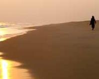
Cape Tribulation QLD, Australia
26.03.2016

The Australian continent became known to Europeans only in the 18th century. Earlier voyages in the southern waters of the Indian and Pacific Oceans also took place, but no documentary evidence of the discovery of new lands has been preserved.
A sharp leap in research occurred in the 15th century, when the era of the Great Geographical Discoveries began. As ships improved technically and navigation developed, Europeans sailed further and further from their native continent. The sea route to India was finally opened, and the question became urgent for researchers and politicians: are there any inhabited lands further south that can be colonized?
The first ships, presumably Portuguese, headed towards Australia back in the 16th century. However, direct evidence of this has not survived. The earliest reliably known visit by Europeans to the Australian coast is considered to be the expedition of the Dutchman Willem Janszoon in 1605. He reached the coast of Australia and even explored it, however, he mistakenly believed that it was part of New Guinea.
“They didn’t notice” the mainland and the Spaniard Torres, who passed through the strait between it and the island of New Guinea in the same year, and another Dutchman, Abel Tasman, who discovered Van Diemen’s Land (Tasmania) in 1642, visited New Zealand and the waters of Western Australia coast.
Correct calculations, the tenacity of the commander, luck and a combination of other important factors led to the fact that the honor of discovering the continent and its subsequent colonization went to Britain. The English navigator and scientist James Cook became the first European who, having explored the shores of Australia, declared it the possessions of his country. This happened during his first circumnavigation of the world (1768-1771).
The main stated purpose of the expedition sent by the British Admiralty was astronomical observations, with the help of which it was supposed to calculate the distance from the Sun to Venus and other planets. Under such cover, the British, secretly from their competitors, made their attempt to find the Unknown Southern Land (Terra Australis Incognita), described in the works of ancient geographers.
Having successfully completed the first part of the program, the expedition moved further east. In addition to Cook, the team included other scientists: the astronomer Green and two botanists (Joseph Banks and Karl Solander), as well as two artists (Buchan and Parkinson). First they explored New Zealand, establishing that it was divided by a strait into two islands, and significantly refining the map of its coast.
The expedition then headed further east in search of new lands. At that time, it was known about the existence of Tasmania in the south and New Holland (part of Australia) in the northwest. In May 1770, Cook's ship Endeavor reached the coast of Australia. He stayed in the bay found there for 8 days. Scientists were amazed by the variety of new plant species (after which the bay was named Botanical) and the local aborigines, whom they could not classify as either blacks or Polynesians.
The next bay described in detail was Port Jackson, located several kilometers to the north. Its characterization as an ideal place for ships to dock led to the city of Sydney being subsequently founded here. Moving on, the expedition managed to travel the entire eastern coast, although the ship was damaged by coral reefs.
Having reached New Holland and discovered a strait between it and New Guinea, Cook entered the Gulf of Carpentaria. Finding himself in familiar waters, on August 22, 1770, he, on behalf of King George III, announced that all the lands he had explored now belonged to the British Empire. Upon returning to his homeland, James Cook received fame as the discoverer of the new continent.
In subsequent years, the Admiralty sent Cook twice more on expeditions in search of the Southern Continent and the passage connecting the Pacific and Atlantic oceans. He made many more discoveries, although he never reached Antarctica (another part of the “Unknown Southern Land” in the works of ancient scientists). In 1779, Cook was killed by natives in the Hawaiian Islands. And Australia, since 1778, began to be used as a place for exile for criminals.
 (1 ratings, on average: 5,00 out of 5)